Arkaim
The Arkaim fortified settlement is located 8.2 km northnorthwest of Amurskiy, and 2.3 km southsoutheast of Alexandronvskiy in the Chelyabinsk region, Bredi district.

The settlement is situated on the left bank of the Bolshaya (Great) Karaganka, flowing together with the river Utyaganka near its mouth. It was discovered in 1987 by a group of the Chelyabinsk State University archeological expedition guided by S.G. Batalova. From 1987 to 1994 it was excavated by the staff of the archeological laboratory guided by G.B. Zdanovich (A.I. Gutkov, S.A. Grigoryev, N.O. Ivanova, A.M. Kislenko, V.C. Mosin).
The deciphering of aerial photographs was made by I.M. Batanina, geophysical research by B.V. Tibelius, B.N. Punegov, paleographic study by I.V. Ivanov (the Institute of soil study and photosynthesis of the Russian Academy of Science-RAS ), quarternary geology Y.A. Lavrushin (the Geology Institute of RAS), paleobotany by E.A. Spiridonova (The Archeology Institute), anthropology by R. Lindstrome (the Chicago University), paleozoology by L.L. Giduchenko (The Kustanay University), P.A. Kostintsev (The Animal and Plant Ecology Institute)
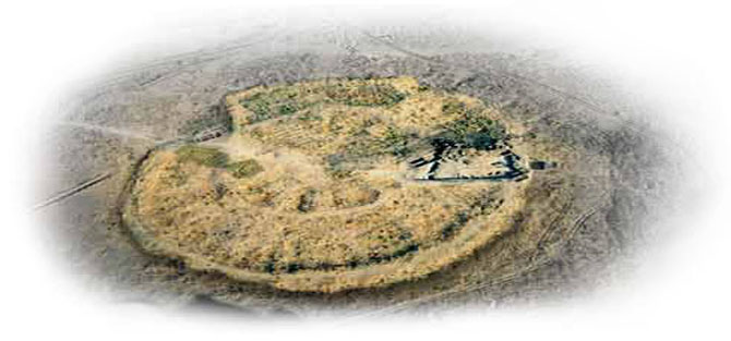
A single layer settlement is round in shape 145 m in diameter. The defensive constructions consist of inner and outer ridges and moats laid next to them from outside. The total area of the settlements within the limits of the defence system is about 20,000 square metres. The modern height of the eroded encircling wall is 0.6 0.09 m.

|
During 5 years of excavations (1987-1991) on the Arkaim settlement 8,055 sq.m. of the area were excavated, 28 dwellings, parts of defensive construction, the north-west entry and the adjacent fragments of defence constructions were expcavated. The archeological collection has 10,120 objects and as a result of these the site can be dated to the second quarter of the second millennium BC (18th 16th centuries BC)
|

|
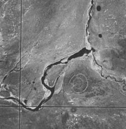
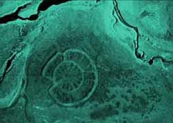
From the aerial photographs of the valley of the Bolshaya Karaganka river around its confluence with the river Utyaganka, the settlement of Arkaim can be clearly deciphered in the southern part of the photo in the form of a round structure with a radial concentric circles showing the ruins of defence walls (lightgrey circles) and trenches of lodgings (dark radial stripes). The ground of the first terrace above the river bed which forms a welldefined promontory at the river confluence, shows traces of the presence of ancient man. A spotted structure in the photograph shows anthropogenic soil changes. Systematic lines of small cavities filled by humus (darkgrey spots) can be evidence of ancient constructions.
|


